Malta's Geography
93 kilometres (57 miles) off the southern coast of Sicily lies the archipelago of Malta, made up of 11 islands of which Malta, Gozo and Comino receive thousands of tourists from all over the world every year. What makes these three Maltese islands so special?
The archipelago of Malta is found in the middle of the Mediterranean Sea, only a few kilometres away from Sicily and in a rather strategic location between southern Europe and Northern Africa. The geography of Malta is fairly identical on all of the islands, which have hardly any rivers or mountains.
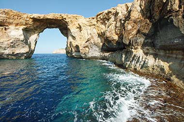
The main geographical attraction of Malta is the Dingli Cliffs and the caves that are scattered around the southern part of the island. The main cities and towns of the island of Malta are located within bays.
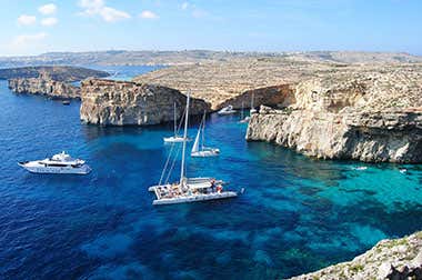
In total, the country is around 316 square kilometres (122 square miles) and is made up of 11 islands, of which only Malta and Gozo are inhabited. The third most important island, Comino, still receives thousands of tourists every year thanks to its famous Blue Lagoon. Only 2 people live there permanently.
The other 8 islands which make up the Maltese archipelago are Cimonotto, Delmarva, Filfla, Halfa, Manoel, Tac-Cawl, Ta Fraben and the islands of Saint Paul. These are mainly islets or small bits of land next to larger islands which are not lived on and receive barely any tourism.
All of the islands of Malta, even the smallest ones, are known for their turquoise blue waters, which are ideal for water activities such as scuba diving and snorkelling.
Gozo
Comino


